


CarryMap
Descrizione di CarryMap
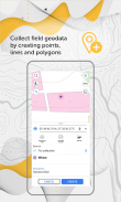
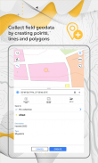
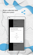
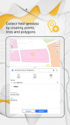
Raccogli dati sul campo, aggiungi e modifica punti, linee e poligoni sulla tua mappa mobile, condividi i tuoi dati con i colleghi.
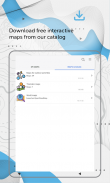
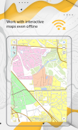
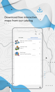
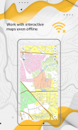
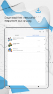
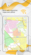
Accedi alle tue mappe ovunque tu vada, tutte le funzionalità dell'app sono disponibili anche offline. CarryMap fornisce lavoro sul campo senza interruzioni senza autorizzazione, pagamenti e acquisti in-app. Con l'app puoi utilizzare le mappe preparate in ArcGIS o scaricare mappe gratuite che coprono vari territori dal nostro catalogo. Le mappe fornite nel catalogo sono state create sulla base dei dati OpenStreetMap.
1. Lavora nell'app senza autorizzazione, pagamenti e acquisti in-app.
2. Aggiungi le tue mappe o scarica mappe gratuite dal nostro catalogo.
3. Crea e modifica elementi punto, linea e poligono sulla mappa.
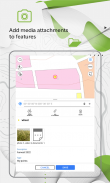
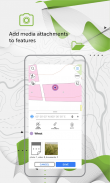
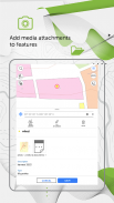
4. Aggiungi allegati multimediali (foto, video e documenti) alle funzionalità.
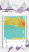
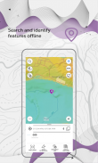
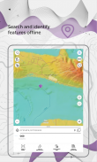
5. Cerca e identifica le funzionalità offline.
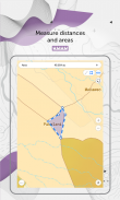
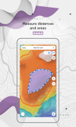
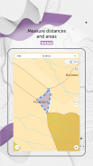
6. Misurare distanze e aree.
7. Crea punti al volo utilizzando la fotocamera del tuo dispositivo.
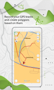
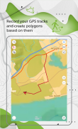
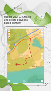
8. Registra le tue tracce GPS e crea poligoni basati su di esse
9. Aggiungi segni grafici sotto forma di testo, frecce o grafica a mano libera alla mappa mobile.
10. Utilizza il ricevitore GPS esterno Bad Elf per trovare la tua posizione attuale.
11. Salva le aree della mappa selezionate come segnalibri per un accesso più rapido.
12. Utilizza le funzionalità della mappa come punti di riferimento o punti di destinazione.
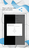
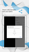
13. Condividi i dati raccolti nei formati GPKG, GPX, KML/KMZ e SHP.
Specialisti del settore dell'energia elettrica, dell'agricoltura, della geologia e della geodesia, dell'edilizia abitativa e dei servizi pubblici, della gestione delle risorse idriche e del territorio, dell'ecologia e della gestione degli incidenti, della gestione urbana e di altre aree in tutto il mondo utilizzano con successo l'app CarryMap per lavorare con le mappe e risolvere le loro attività lavorative quotidiane.
L'app CarryMap è fornita per funzionare con mappe del formato mobile specifico CMF2. Per esportare le mappe ArcGIS in questo formato, avrai bisogno di CarryMap Builder, un'estensione di ArcGIS Desktop. Visita https://builder.carrymap.com/ per saperne di più su CarryMap Builder.
Per ulteriori informazioni sull'applicazione CarryMap, visitare https://carrymap.com.
Le tue domande o commenti sono benvenuti a support@xtools.pro.
Iscriviti alla nostra pagina Facebook all'indirizzo https://www.facebook.com/carrymap/.
Iscriviti al nostro canale YouTube all'indirizzo https://www.youtube.com/c/CarryMap/videos.
CarryMap - Versione 6.2
(17-12-2024)CarryMap - Informazioni APK
Versione APK: 6.2Pacchetto: com.dataeast.carrymapUltima versione di CarryMap
Altre versioni


 3.64
3.64


App nella stessa categoria

Potrebbe piacerti anche...


